We’ve gotten to know a “new” property adjacent to the Santa Fe National Forest over the last couple of years thanks to a friend and fellow aviation enthusiast, Rol Murrow. On a recent visit and after a couple of gritty cups of decaf and interesting conversation with Rol, I ventured off on the ranch’s north boundary to find a little bit of peace and quiet. The day was cloudless and reasonably warm for this time of year. A stiff wind out of the northwest made if feel colder that it really was. The sun baked the limestone cliffs and cast long, fall shadows behind the pinyons, junipers and occasional ponderosa pine. I spent all afternoon ambling among the rocks and trees unsuccessfully and half heartedly looking for a stray artifact that might have surfaced in the most recent storm.
Murrow Ranch on the Divide
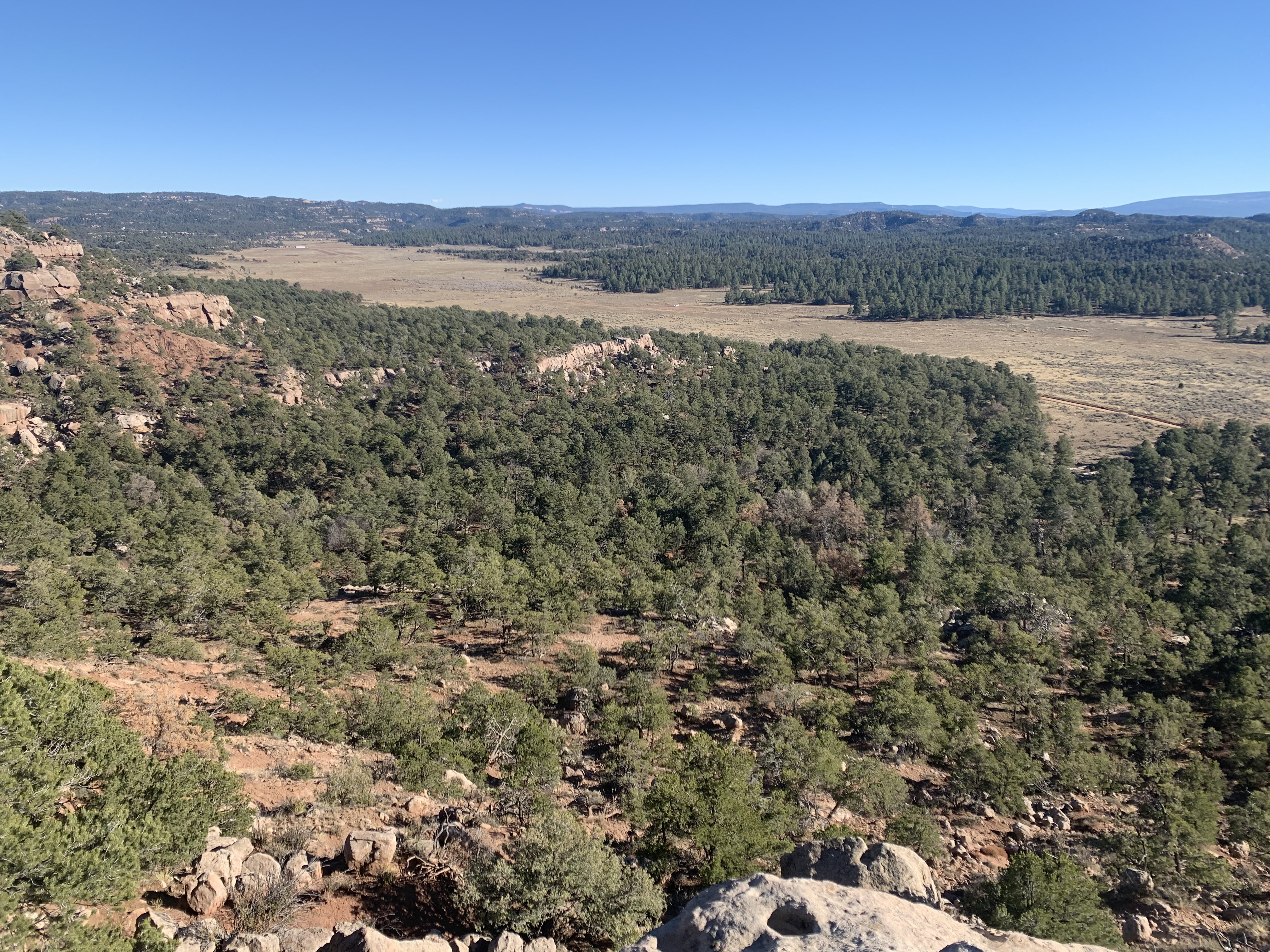
The Murrow ranch is perched atop the continental divide in NW New Mexico about 2 hours north of Albuquerque. The ranch features a 4000′ dirt airstrip which makes it perfect for a quick getaway. The bustle of the city melts away on the trip north and about the only noise you’ll notice here comes from the commercial jets on the Q130 high altitude, GPS route. The Q130 passes directly overhead with planes loaded with cargo and people who, I imagine, have no idea what they are passing over. The ranch was previously the home of a group known as the Gallina culture. As I walk west along the limestone ridge, I wonder what the Gallina people, or more recent, early 20th century occupants of this land, would have thought of such a spectacle overhead. In the photo left, the ruins of a more recent homesteaders log cabin can be seen in the edge of the clearing at lower right between the trees and the gravel FS313 road.
The Gallina group were indigenous people that lived in the area up until about 1,200 AD when they mysteriously vanished from the area. Anthropologists speculate that the exodus could have been drought induced or a product of an invasion of another larger band of folks. Pieces of the black and white pottery of the Gallina people are found here on the ranch and for miles around. They also left cliff dwellings, weapons, tools and even skeletons. Just a few miles from the ranch, sits one of the dozen or so cliff communities that have been discovered in New Mexico – The Nogales Canyon Cliff Dwellings.
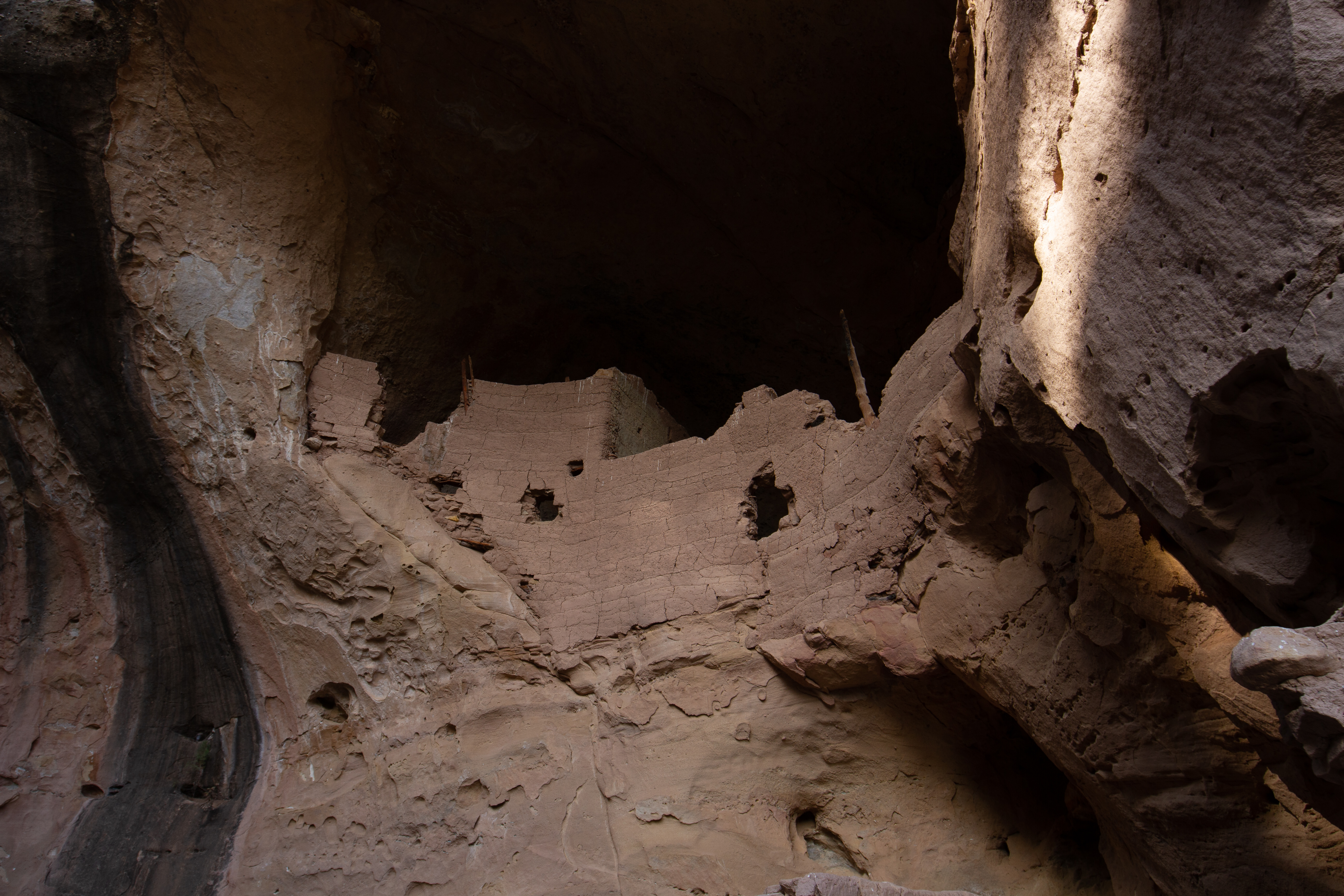
Nogales Cliff Dwellings
My wife Claudia joined me later in the week for some hiking and camping. We decide to visit the cliff dwellings and enjoyed the short, forested hike into the site as well as the fascinating ruins. Some miscreants had scratched their names into the ancient adobe walls which was unfortunate. However, the site was very impressive and we had the place to ourselves. Ancient adobe construction can be seen here with wood reinforcement sticking out of the crumbling walls. This wood is over 800 years old!
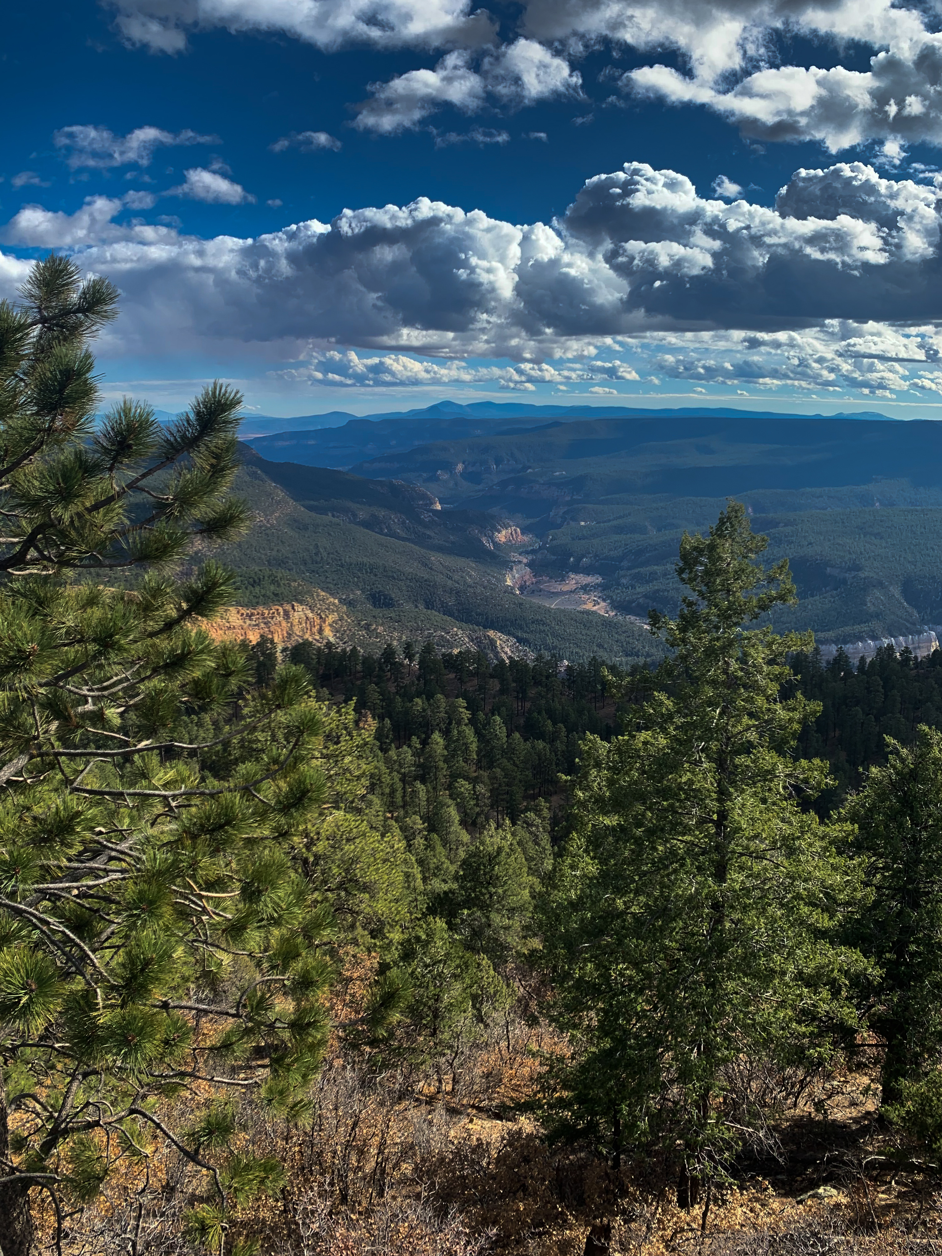
Golondrina Mesa & Chama Wilderness – Sangre de Cristo Mts. beyond
We continued over and camped in the Canjilon mountains just east of the ruins and the Murrow ranch. The area is characterized by “basin and range” geology (See new banner photo above) which features massive, tilted blocks of sedimentary rock that span hundreds of millions of years of geologic history. Just east of the Canjilon, the rock drops about 200 million years into the bottom of the Chama River canyon as water continues to cut deeper into history and makes it’s way down to the Rio Grande to the east. Below us, we can see Golondrina Mesa which looms over the confluence of the Chama and the Gallina rivers, an area which is contained within the Chama Canyon Wilderness Area.
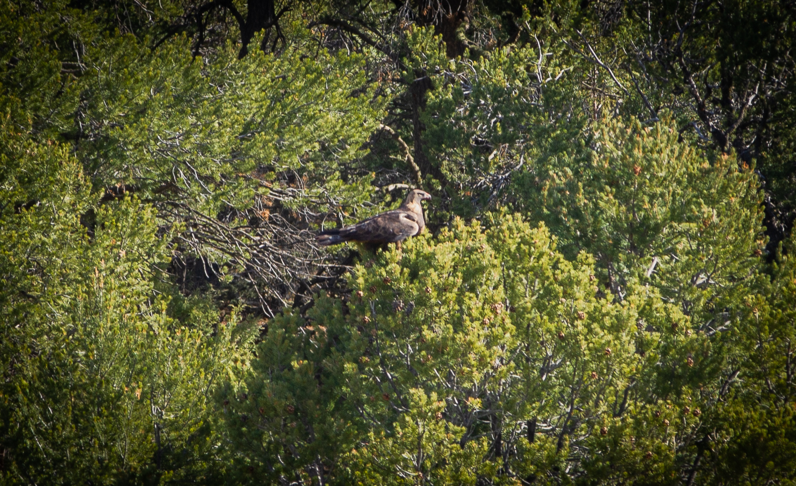
Juvenile Bald Eagle
Back at the ranch the following day, we find ourselves back in Rol’s green, plastic lawn chairs, swapping stories. He’s been here for a long time and knows all kinds of folklore about the Gallina area. As more recent visitors, we offer impressions of things we’ve seen more lately. The wind has died down and the sun warms another perfect afternoon on the ranch. A bald eagle mom circles over her chick sitting in a pinyon pine nearby and immediately becomes the most notable sighting of the day. I try to imagine one of the Gallina people sitting here a thousand years ago looking at a similar scene and wonder who will discover and occupy this property in another thousand.
==============================================================
PS: The birds eye view here shows some of the above referenced locations.
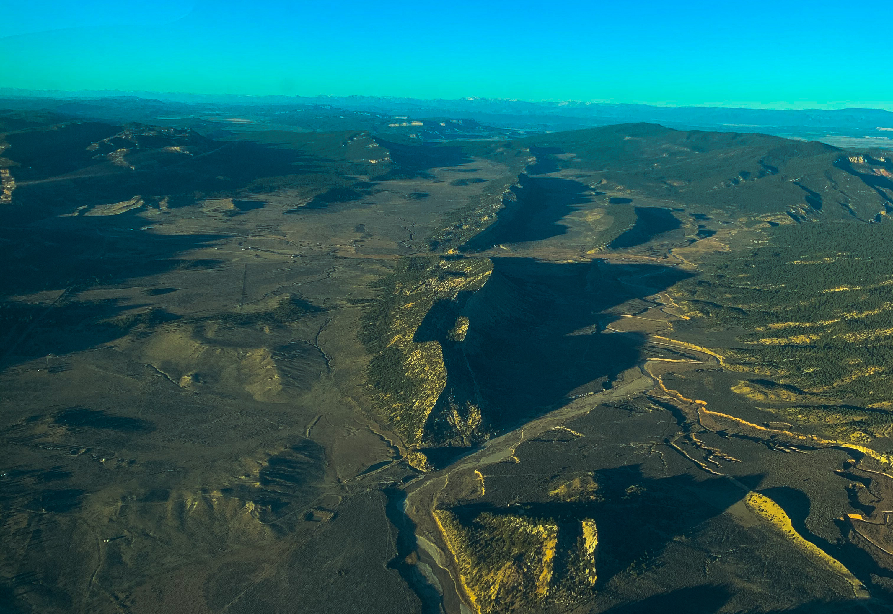
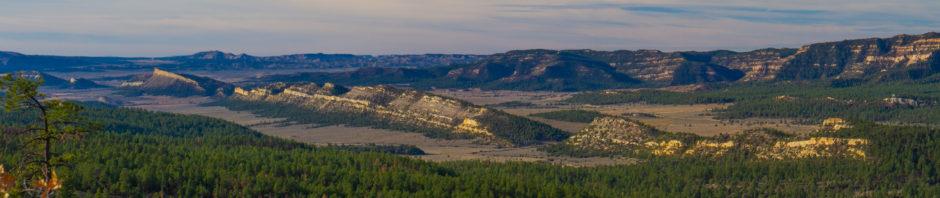
Over Gallina River looking North up NM Hwy 112
The shadowed valley at center left edge is where Nogales ruins are located and the Murrow ranch is off the frame to the left along FS313. The uplifted valley and tilted “basin & range” fault blocks can be seen either side of NM212 center frame with the Canjilon Mountains at right of the frame. The Gallina river winds bottom right to right center of the frame and the Chama river is in the valley just right out of the frame. The Canjilon mountains at right are bookmarked by Gallina peak at north and Dead Mans peak on the south end. The Tusas mountains can be seen distant horizon top right as they extend into the San Juan range of the Rocky mountains near Pagosa Springs at top left.
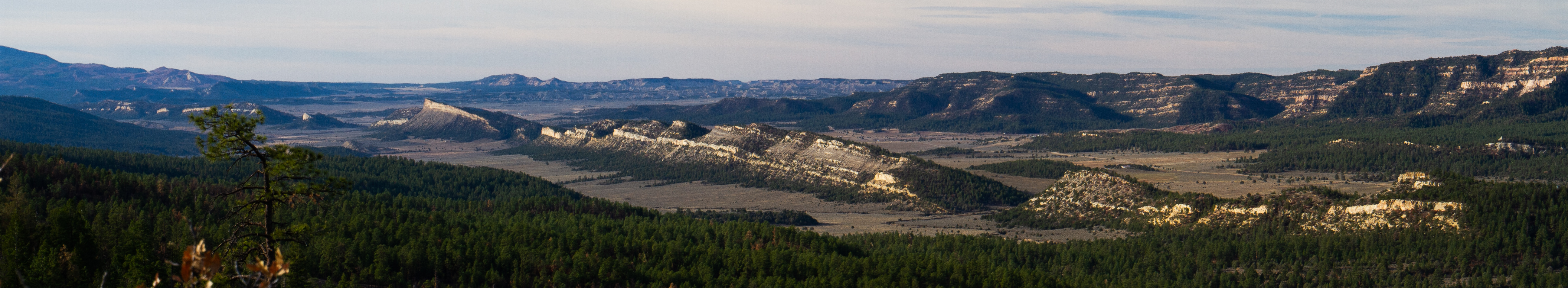
Hogback from Gallina Peak
This picture, also shown at the banner of my blog, is taken from the ridge at the right of the photo above looking south west. The hogbacks are seen from a different angle. The earth is pulled apart from below and large blocks of crust fall into the space – creating this spectacle of nature.