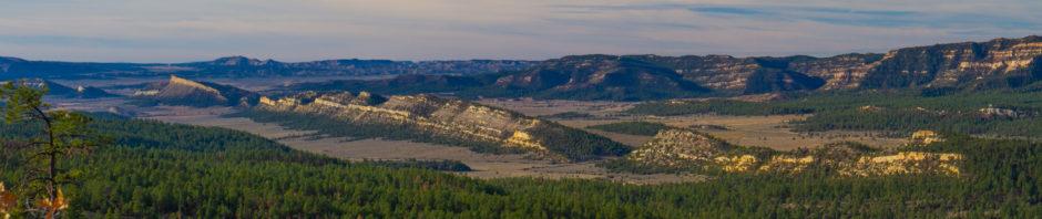
Looking south from Me Own
In the last couple of years, we’ve visited the Aldo Leopold Wilderness a number of times by flying into a US Forest Service backcountry airstrip called “Me Own”. It’s a pretty unique spot, surrounded by mountains, that features a well maintained gravel airstrip with a trailhead into the ALW just off the south end of the landing area. Me Own is one of a group of airstrips used by the USFS for firefighting (note burn scars on the hills behind strip) that sit right in the middle of one of the largest contiguous stretches of mountain wilderness in the lower 48 and our flight from our home base in Albuquerque. The hour and a half long trip in the Cessna would take 5 hours in a car.
Tuft formations middle fork Gila River
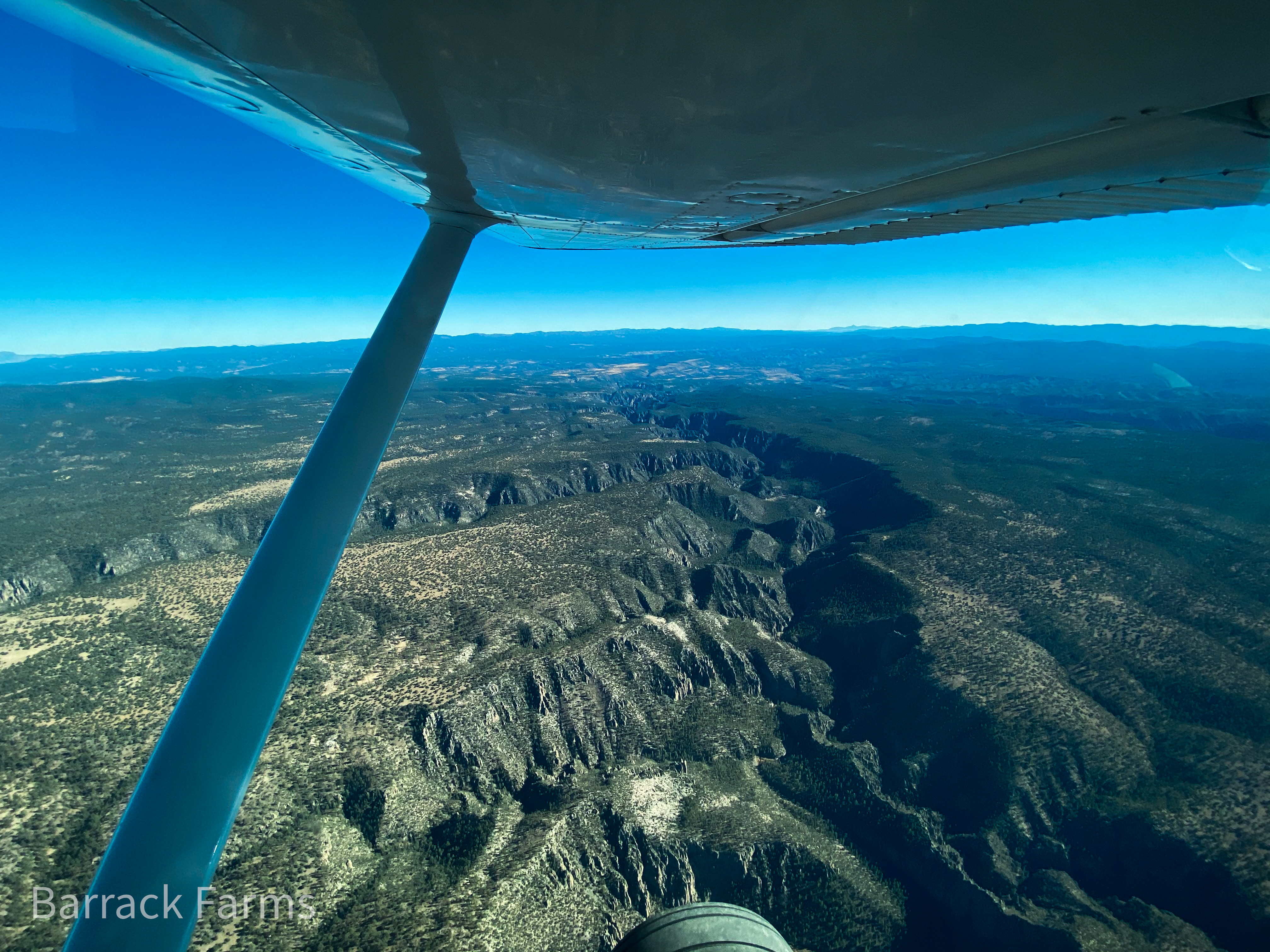
The approach into Me Own reveals the volcanic origins of the Gila river basin as the middle fork (shown in photo) cuts through the Oligocene volcanic tuft that houses the Gila Cliff Dwellings National Monument. These tuft formations appear all over New Mexico with the most well known spot being the Tent Rocks National Monument near Santa Fe.
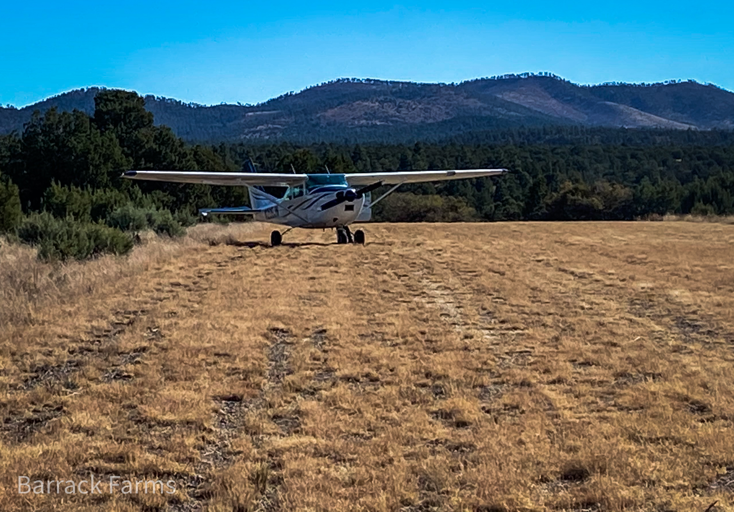
Once I shut the engine down, we were welcomed by the overwhelming quiet that surrounds and welcomes the visitor. While this spot can be the hub of activity during the fall hunting seasons, most days are quiet and still with the only sounds being those of the wind or the calls of the many species of birds and mammals that transit and live in the area. This day, not even those sounds seemed present – though we were later visited by a large group of mountain bluebirds and saw some flickers and ravens. The windsock at the airstrip hung, for the most part, limp, periodically straining in a futile effort to bring itself to life anytime a light breeze passed by. It was very quiet.

ALW Entry Sign
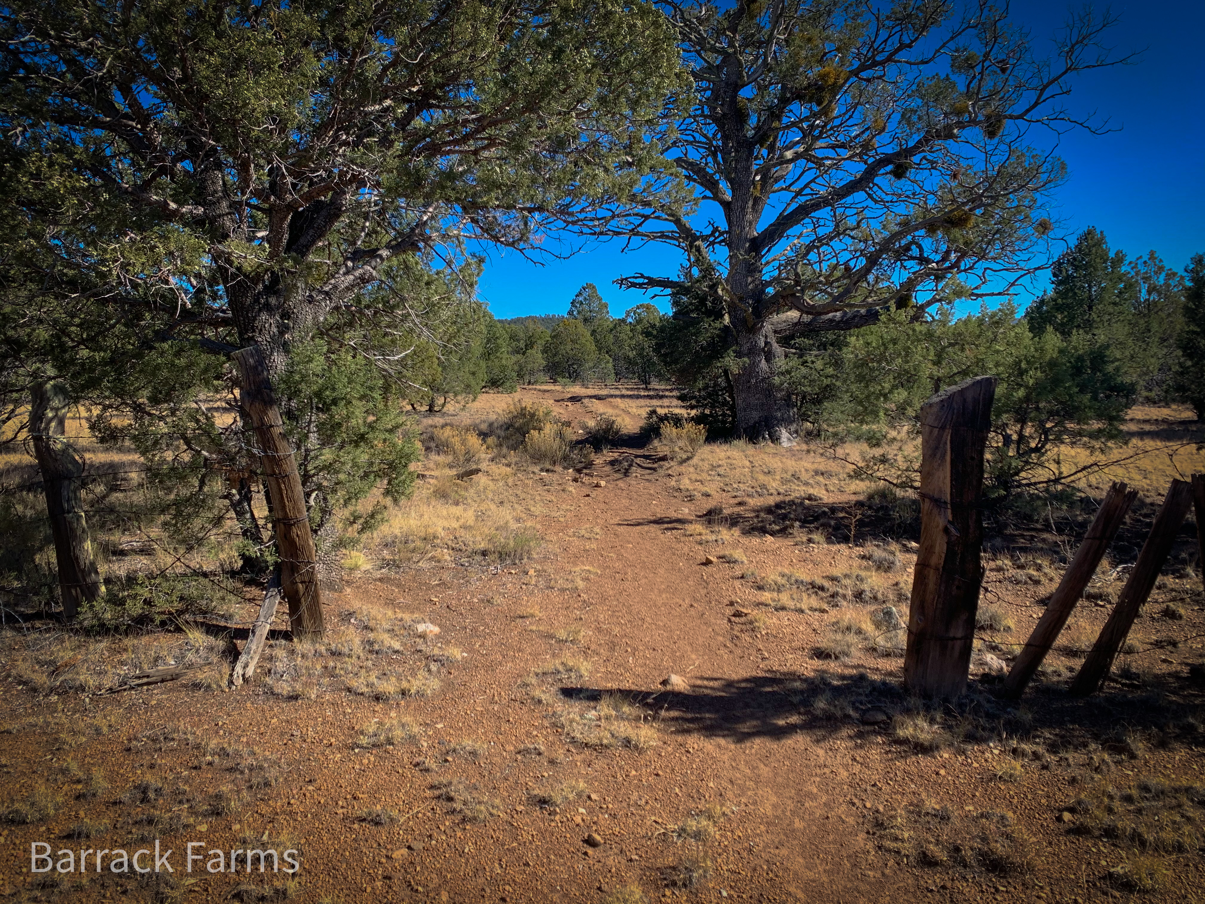
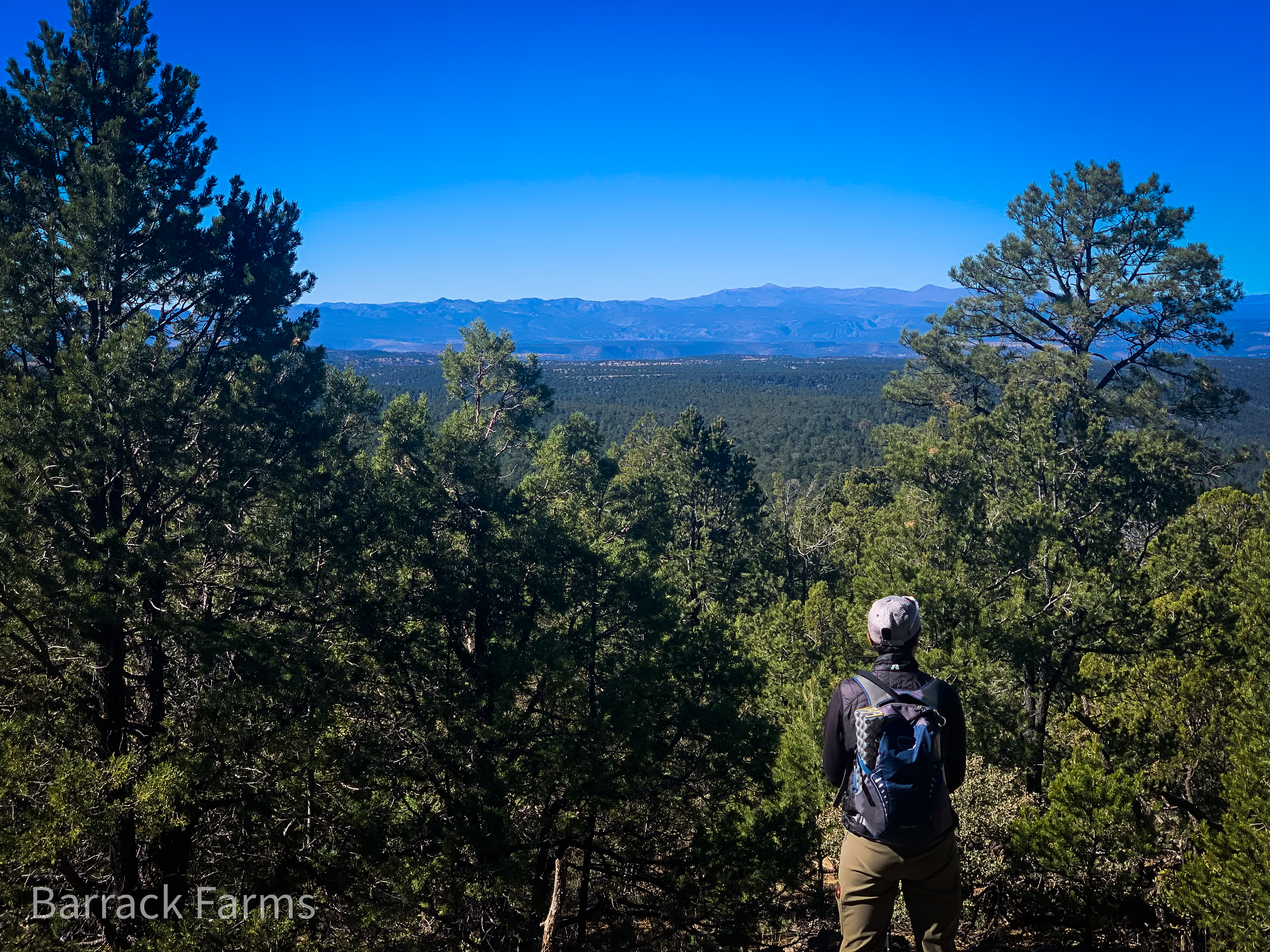
We grabbed the daypacks and headed east, past the Forest Service building, through the stock gate, past the old, worn entry sign and into the wilderness. The fall sun had, by then, begun to warm the ground, casting long shadows and shaking off the frost of the previous night. Forty degree daily swings in temperature and not uncommon here. The elevation starts at around 7,500 feet above sea level and the summit of Me Own Hill- our objective – is 600 feet above that. These elevations in New Mexico can pretty much guarantee a delightful day during all but a couple of the most extreme months of the year. Best to have a warm bag to climb into if you plan to stay the night.
ALW Entrance & Me Own Hill distant
As we enter, I notice the miles of fencing, mostly remnants really, you see all over this wilderness. Fencing that testifies to a culture of livestock management that defines New Mexico. Ranchers have, and still do, use New Mexico’s forest land as a food source for their cattle. Hoof prints of horses used by ranchers and hunters can be seen everywhere in the wilderness – another reminder of the culture that is woven into the fabric of the land here. Passing through the fence opening, I marvel at what must have been the superhuman effort required to erect the thousands of miles of fencing that define individual territories within some of the most remote areas anywhere in the western U.S. Erected by men who’s life’s work is reflected in the hand hewn fenceposts and rusted barbed wire that remain – not to mention the millions of stock, long eaten, that passed through gates just like this one. It makes me laugh enviously when juxtaposed against people who wax philosophically about the meaning of life and a higher purpose.
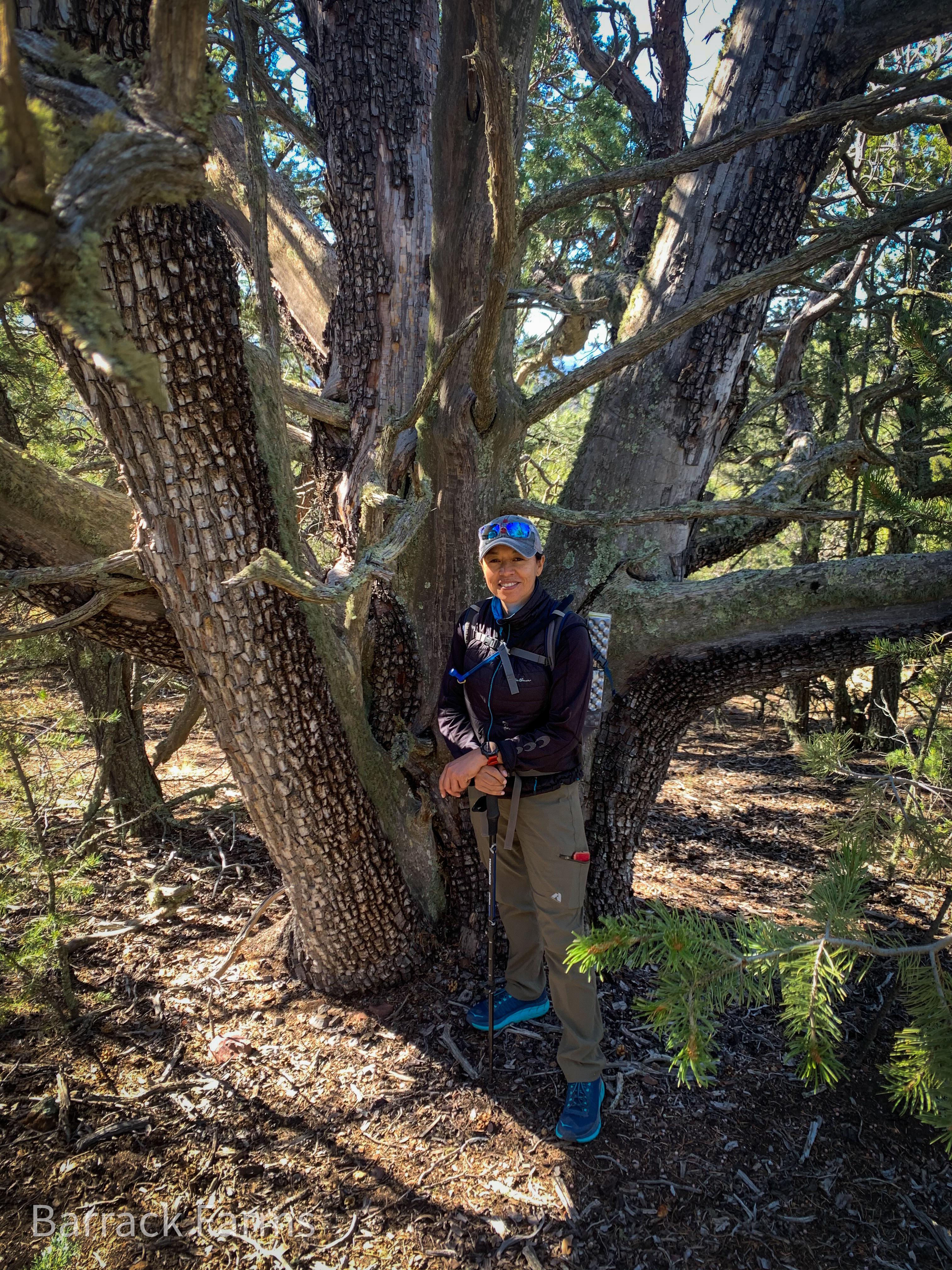
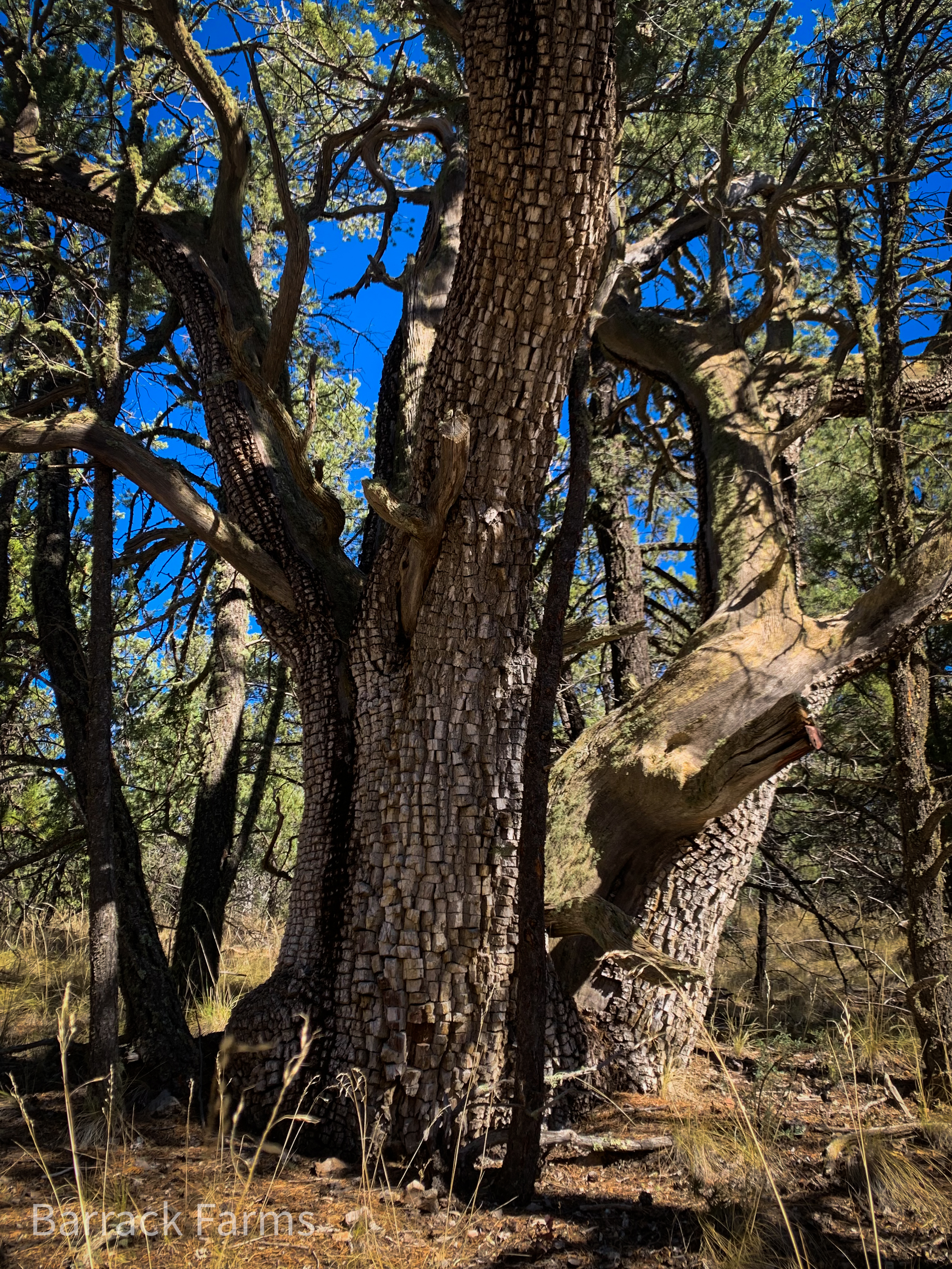
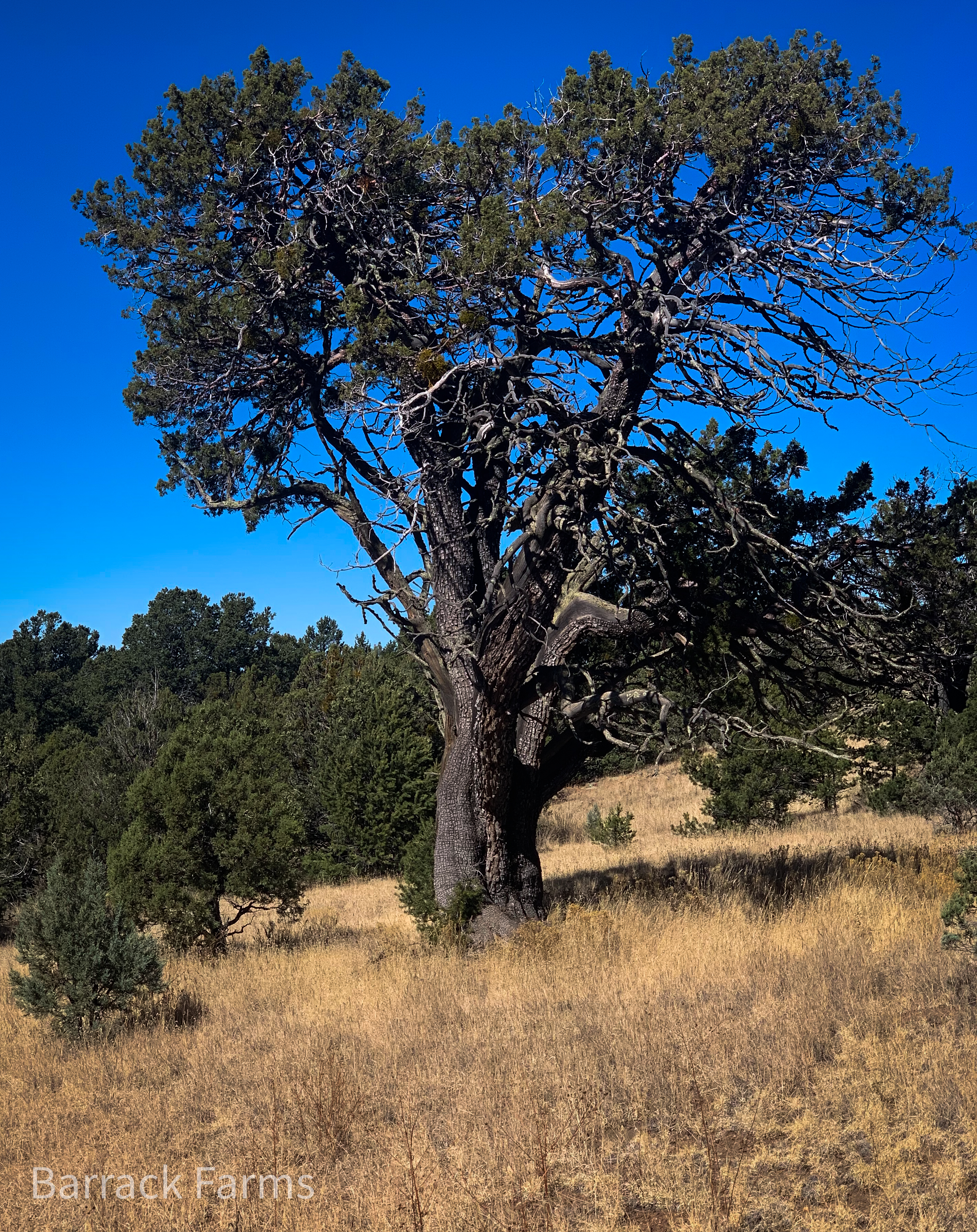
Alligator Juniper
Twisted wood
Another highlight of hiking around in this part of the world is the alligator juniper – Juniperus deppeana in the Latin. These trees are both diminutive in height and surprisingly massive in stature. While the tallest of these trees we saw here probably reach a height of 50′, most are 2o-30′ high.
Alligator juniper leaning into the sun
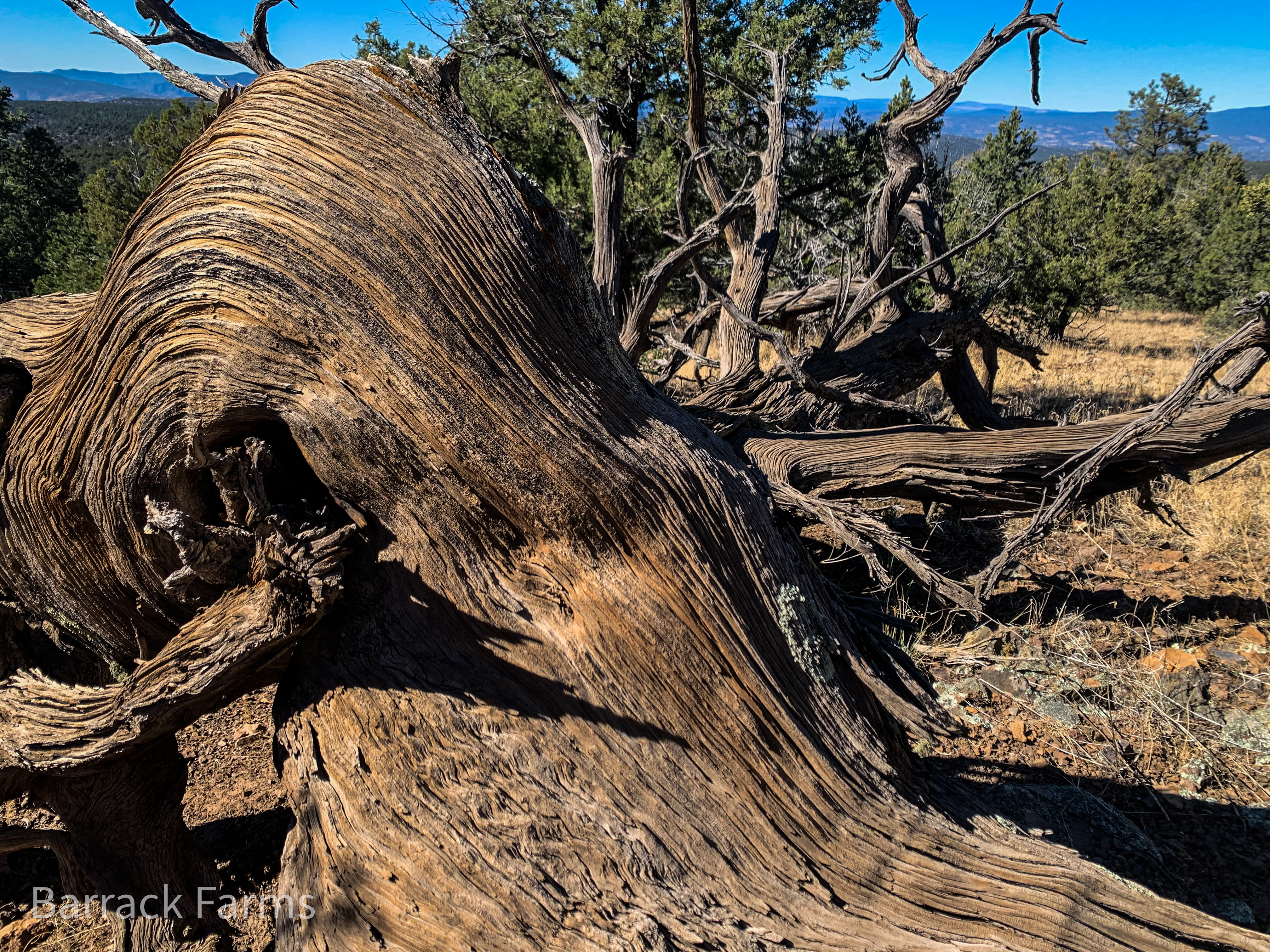
Meadow matriarch
The most magnificent examples are over 5′ wide at the base. Branches that seem dead, can have one small vein of live cambium that supports a small bunch of foliage that hangs on in defiance. These trees are named for their bark.
Where the bark has fallen away from age, a twisted, tortured grain and multiple fire scars are exposed – a testament to the harsh environment in which these monuments have made their home. Elderly or fallen trees reveal a truly hard life while hope springs nearby as new seedlings emerge from the hardscrabble soil.
Mogollon Baldy 40 miles distant
In photo left, in the southwest corner of New Mexico, we gaze over the vast, uninterrupted mountain wilderness that forms the upper eastern limits of the Gila River watershed. The Gila is one of the most interesting and unique rivers in the west with it’s watershed spanning a large area including 2 states and even crossing the border into Mexico. This day we were standing on the slopes of the far eastern edge of the watershed. Below the distant peaks the waters of the west fork, middle fork and east fork of the Gila river form a confluence and begin their long journey to the Pacific Ocean. It’s hard to imagine that actions we take here can impact humans, fauna, flora and even terra firma over 400 miles away in Yuma Arizona and even further as the waters from the Gila empty into the Gulf of California via the Colorado River. Unfortunately, the waters of the Gila don’t often reach the gulf as they are diverted for irrigation to feed a hungry population living in the massive human environmental disaster also known as Phoenix. Anyone who travels to Phoenix has to appreciate the irony of planning such a water hungry, artificial, oasis in the middle of such an inhospitable desert. My guess is that few of it’s residents or visitors are aware of or can appreciate the fact that, what we are looking at today, in large part, allows them to exist. That said, water officials are keenly aware of the Gila’s contribution as proposals to dam and otherwise “manage” the fragile river have been around for decades.
Standing here in his namesake wilderness, I remember reading Aldo Leopold’s book Sand County Almanac a few years ago. For me, this book was a confirmation of the importance of being thoughtful about the natural world around us. How each of us should find some, albeit small way of preserving the natural world for future generations.
“To those devoid of imagination a blank place on the map is a useless waste; to others, the most valuable part.” A Sand County Almanac and Sketches Here and There
Aldo Leopold saw the American wilderness begin to disappear during his short but meaningful life and worked to influence his contemporaries to save it. Today we find ourselves in the eponymous legacy of Mr. Leopold. As you read the SCA, AL tries to instill in the reader, just how things seemingly distant and unrelated are not disconnected and are tied together in a connected and dependent reality.
“Conservation is getting nowhere because it is incompatible with our Abrahamic concept of land. We abuse land because we regard it as a commodity belonging to us. When we see land as a community to which we belong, we may begin to use it with love and respect.”
While we didn’t see another human being on our trip today….. Who knows? Maybe someone with the power to make sweeping changes to how we look at wilderness, will visit this or some other wilderness like this someday and be inspired. We stand here today in awe of the miracle that this vast wilderness still exists in our modern world of consumption. We are fortunate to be able to experience this miracle, the existence of which, Aldo Leopold has played a big part.