Recent political and viral (COVID) turmoil makes looking for ways to find a bit of solitude all the more important. Fortunately, New Mexico has seemingly unlimited opportunities at every point on the compass dial. We left town on a 270 degree heading this Saturday morning with the intention of visiting a local New Mexico park, completing a 150 mile overland route in the truck, getting in a few hikes and enjoying some peace and quiet. Malpais National Monument sits on the continental divide and is accessed off of I-40 just east of Grants NM. The eastern and western entrances feature paved roads but most of the park can only be visited via primitive dirt roads that are sometimes smooth and other times punctuated by rough volcanic rock. These roads were built long ago to access remote water holes and to support timbering and the sheep and cattle ranching that still continues today.
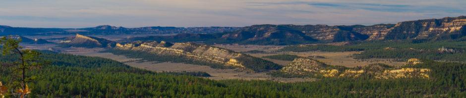
We took state highway 117 south along the eastern margin of the park with tall, weathered limestone and sandstone cliffs on the left and a plain of massive lava flows to our right. The flows look recent but support a surprisingly healthy pine and juniper forest that seems out of place in this inhospitable rock scape. The lava was deposited around 3,000 to 4,000 years ago according to my research. Twisted, gnarled, pocked by collapsed lava tubes and marked by pressure ridges, the sight this field of lava telegraphs the extreme force that was required to push this huge amount of rock over 40 miles north to the interstate.
Leaving the sedimentary cliffs and safely south of the lava flows we turn west, right into the park wilderness on a smooth dirt road – the Cibola County #42. One might think that the lava originated here. However, outcroppings of volcanic rock are exposed here and there and you realize that you are still traveling over a vast bed of lava – probably an older one (oldest flows in the area date to 150,000 years) that is covered with a thin patina of fine soil and sand. This thin layer of soil allows us humans to travel across the plain and provides some provender for the livestock that still use the area. Roads and railroads that cut through this territory follow these soil layers as the exposed lava flows would be almost impossible – and require immense effort – to traverse.
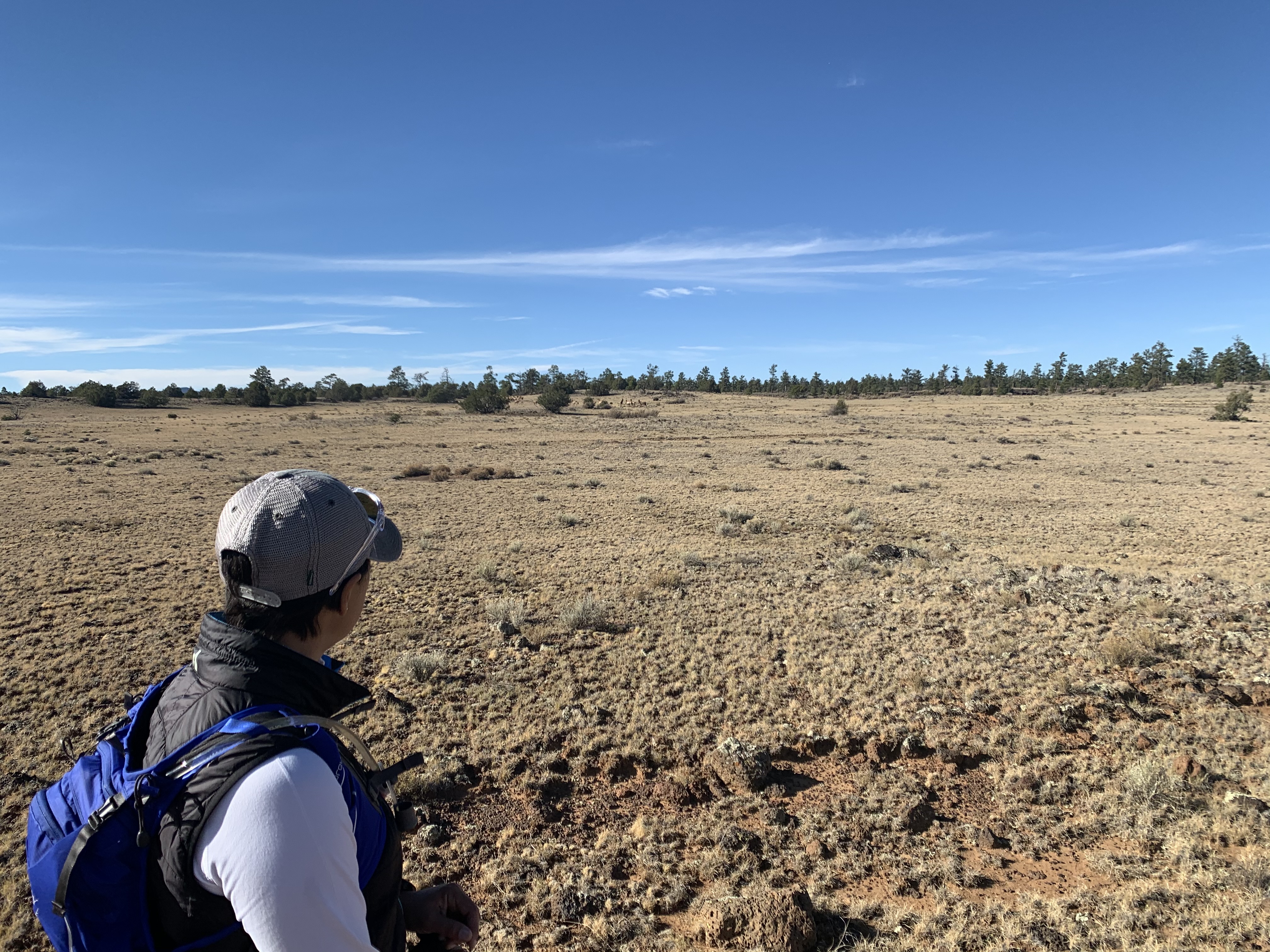
Elk barely visible as they make the distant ridge and timber
We found the “Hole in the Wall” trailhead and wandered around for a couple of hours among pinyon and ponderosa pines and junipers and marveling at the lava flows. At one point a herd of about 75 elk crossed in front of us as they moved up to a ridge to graze on the sparse grass left over from the summer season. We watched them for about 20 minutes with envy as they seemed to go about their daily routine completely ignorant of the tumultuous world that we’ve created around them. There were lots of western meadowlarks foraging around along with flickers and the ubiquitous ravens. Timber defines the edge of the lava flow in this photo.
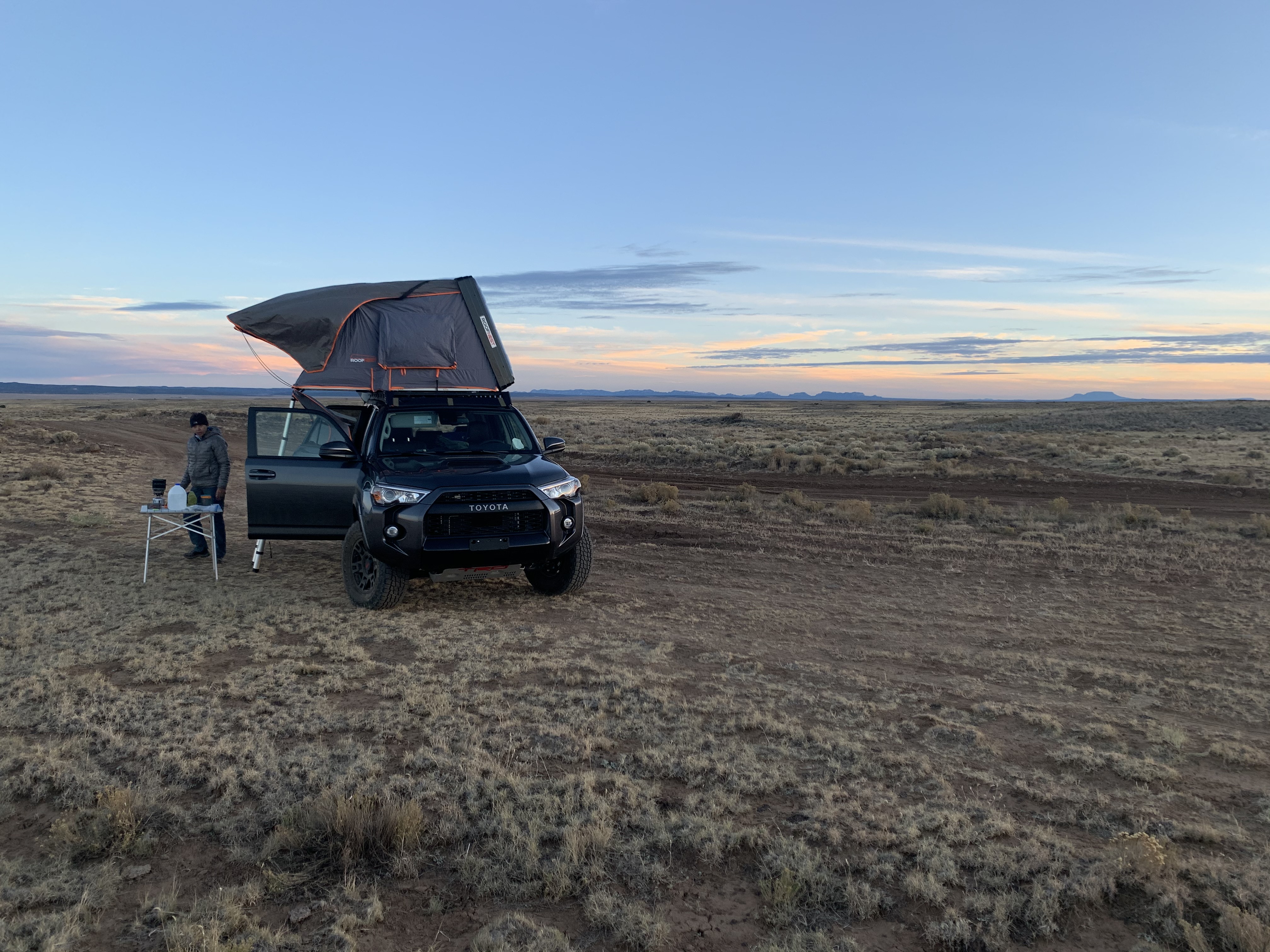
Roof top tent deployed on the Malpais plain
After the hike, we continued along the #42 County Road until we found a camp site with a great view of all of the mountains that surrounded us. Framed by the Cebollita ridge to the east, Mt. Taylor’s massive volcanic shield to the north, the Chain of Craters to the west and the Zuni mountains beyond along the Arizona border, and the myriad rugged peaks of the Gila Wilderness to the south, we camped alone save a few coyotes that passed by in the night, singing their songs to the full, blue moon.
The next morning we broke camp and continued along the #42 road determined to find a cone to climb to get a view of the entire landscape. Cerro Brillante and Cerro Colorado, two sibling cones on the SW corner of the wilderness caught our eyes. We parked and followed the Continental Divide trail until we found a good spot to go cross country and scramble up the 700′ cinder cones to a magnificent view at the top. An awe inspiring view was our reward. The aforementioned peaks that surrounded us came into sharper relief as a cold wind washed over us. I was so awestruck that I forgot to take a picture. On the way down, a huge flock of pinyon jays offered colorful respite from the drab greys and greens as they foraged among the pines below.
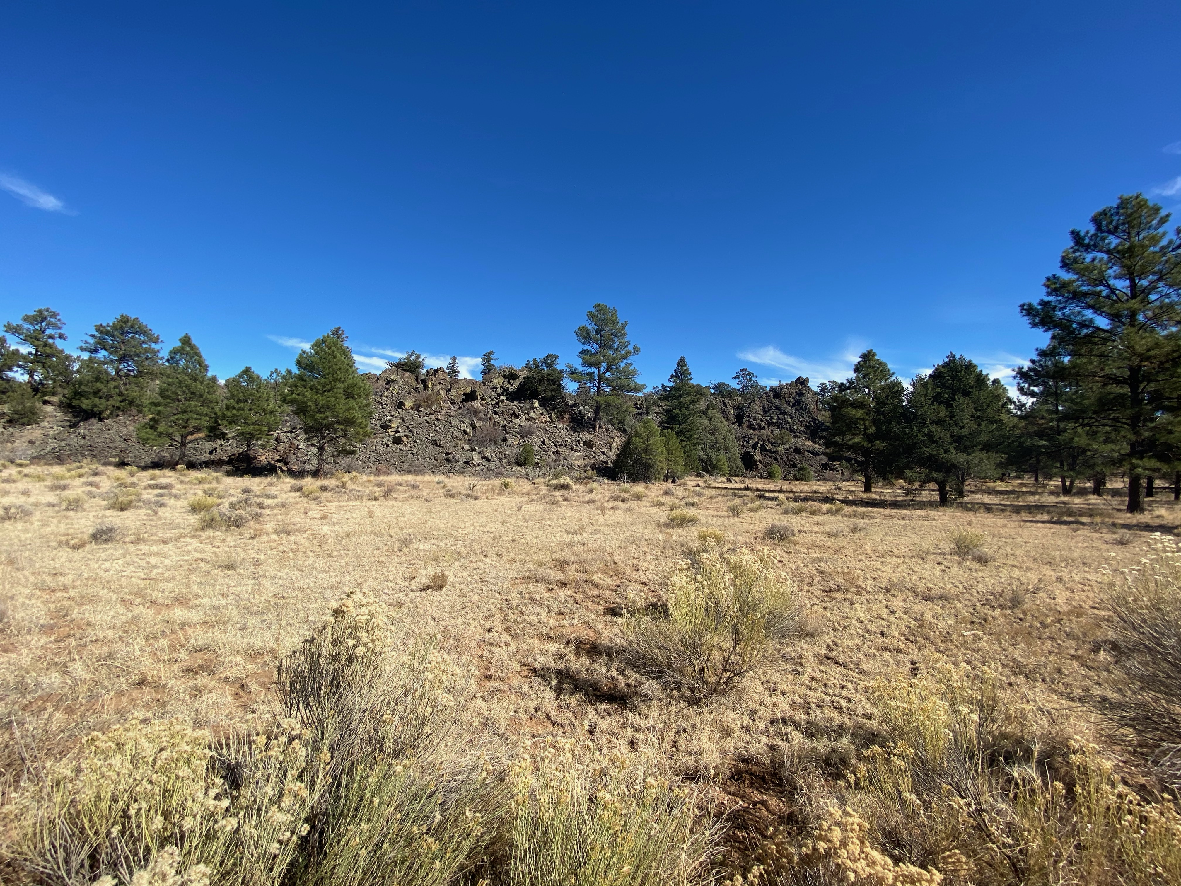
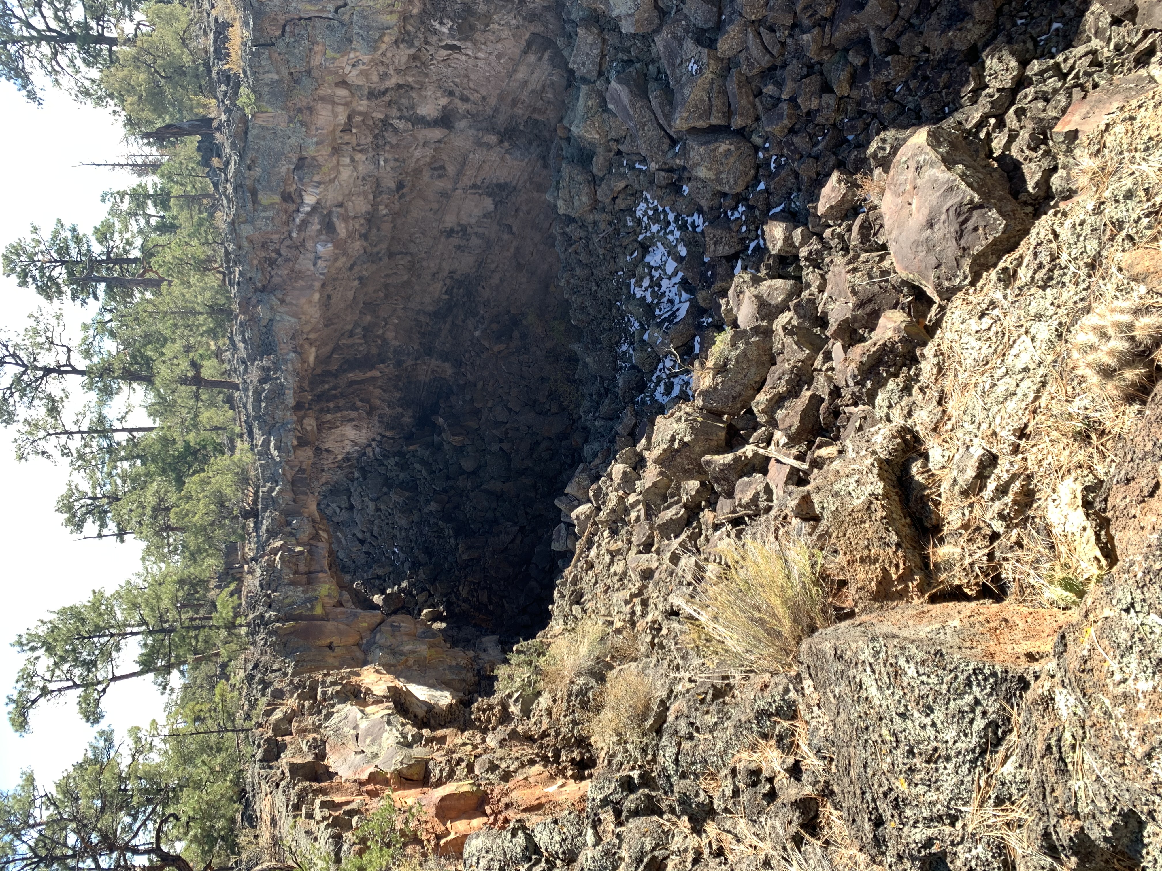
The “Big Tube” lava flow stands 60′ above the ground level next to access road
Back on the #42, we continued to the Big Tubes turnoff and drove into the trailhead along a massive, 60′ tall (above ground/older lava flow), 17 mile long lava flow that features a number of collapsed ceilings of a 75′ diameter lava tube that fed the flows growth as it covered the area. Roadrunners, American robins and mountain bluebirds seem to own the fence rows along the #42 and the interior roads.
We arrived to a vacant parking area and we enjoyed the half mile trail to the lava tubes as ground squirrels scurried around on the sharp lava.
The main lava tube was impressive but also notable were the hundreds of smaller collapsed tubes and ridges that made this short trail very challenging to navigate. Large cairns made of volcanic chunks mark the trail and give one a sense of security while walking through this inhospitable area. Funny how the ponderosa and pinyon pines seemed to thrive in this environment, finding nutrients in the rocky, volcanic foundation in which they make their home. It’s looks like a hard life.
Here are a couple of photos of the collapsed lava tube at the end of the trail.
Seven Bridges at the Big Tube
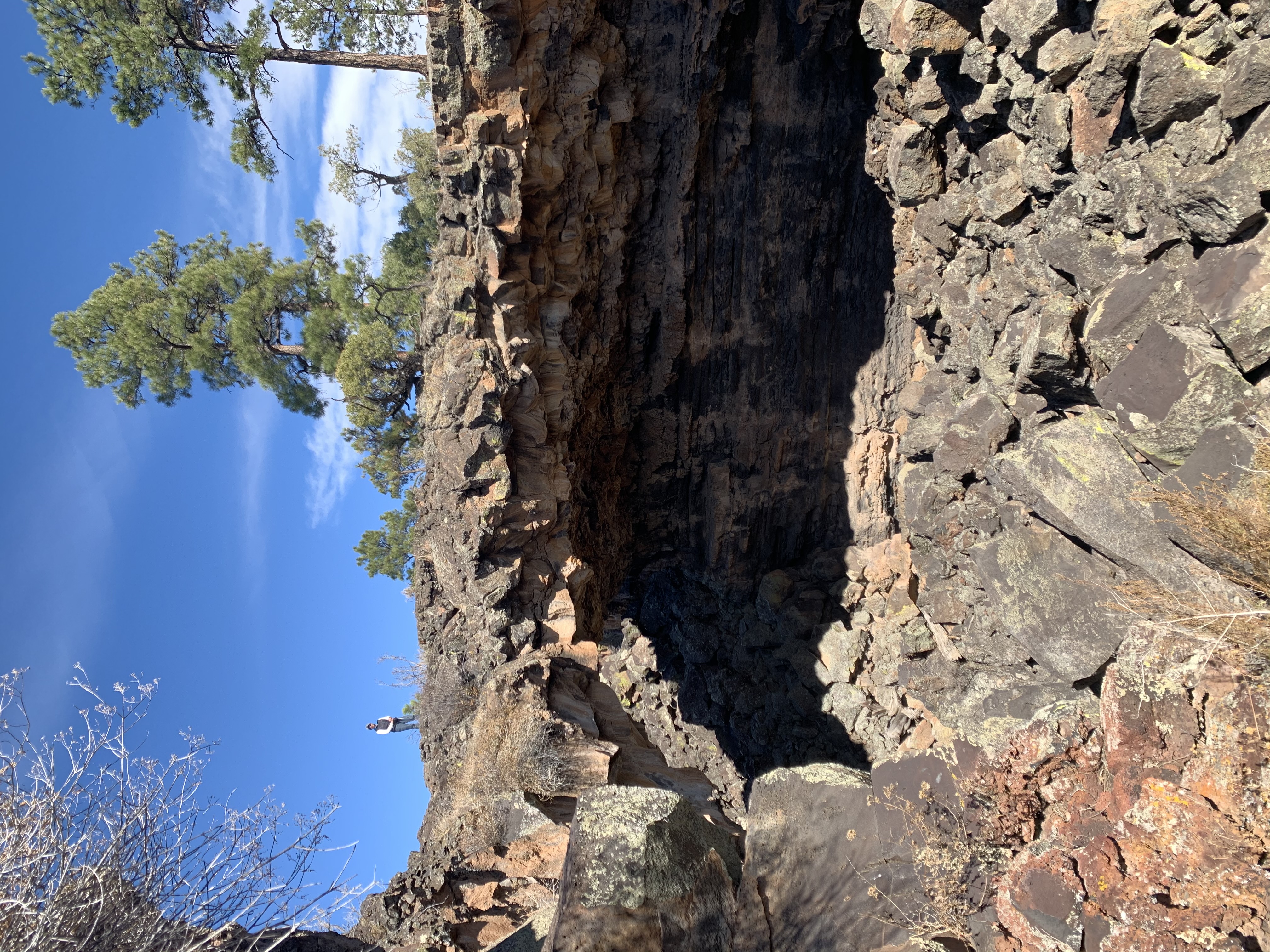
One of many natural bridges created by the collapsing roof of the lava tube
After the “tubes” we made the pavement again at highway 53 and made the sad trip back to the incessant din of the semi-trucks barreling down I-40. After such a peaceful couple of days in the wilderness, the shock of being back in civilization – if you want to call it that – is quite a dramatic transition. The battlefield that is the interstate immediately makes you value the solitude that you can find by leaving the beaten path once in a while.
Here are a couple of links to more information about the National Monument and adjacent wilderness area managed by the BLM.