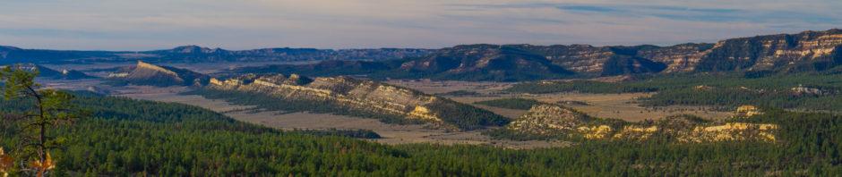
A much anticipated and hyperbolically reported winter storm passed through New Mexico a few days ago. While some spots did get a good bit of snow, (Ruidoso, a Sacramento mountain resort town SE of Albuquerque set a snowfall record for December) it was really a non-event here in ABQ. We got 2 inches of the fluffy, dry, powder snow here at our house and most roads were clear by mid-morning the next day. Just south and west of town, there were areas that received barely a trace of the white stuff. That said, it was a beautiful scene when the clouds lifted and the desert sun revealed the Sandia mountain range looming over the city shrouded in it’s icy winter veil. The air was cold and perfectly clear – great conditions for the normally aspirated (fancy for carburated), large bore engine of a Cessna 182. So we launched.
After the preflight inspection, we notified ATC that we’d be flying down the Rio Grande valley past the Albuquerque VOR to the southern end of the Manzano Range. We asked for “flight following” which allows controllers to monitor our flight helping us to avoid other traffic in the busy Albuquerque airspace. In the route map below you will notice that about half way into our trip we had to do a 360 degree turn to avoid getting too close to a Delta Airlines jet descending to land at the ABQ Sunport.
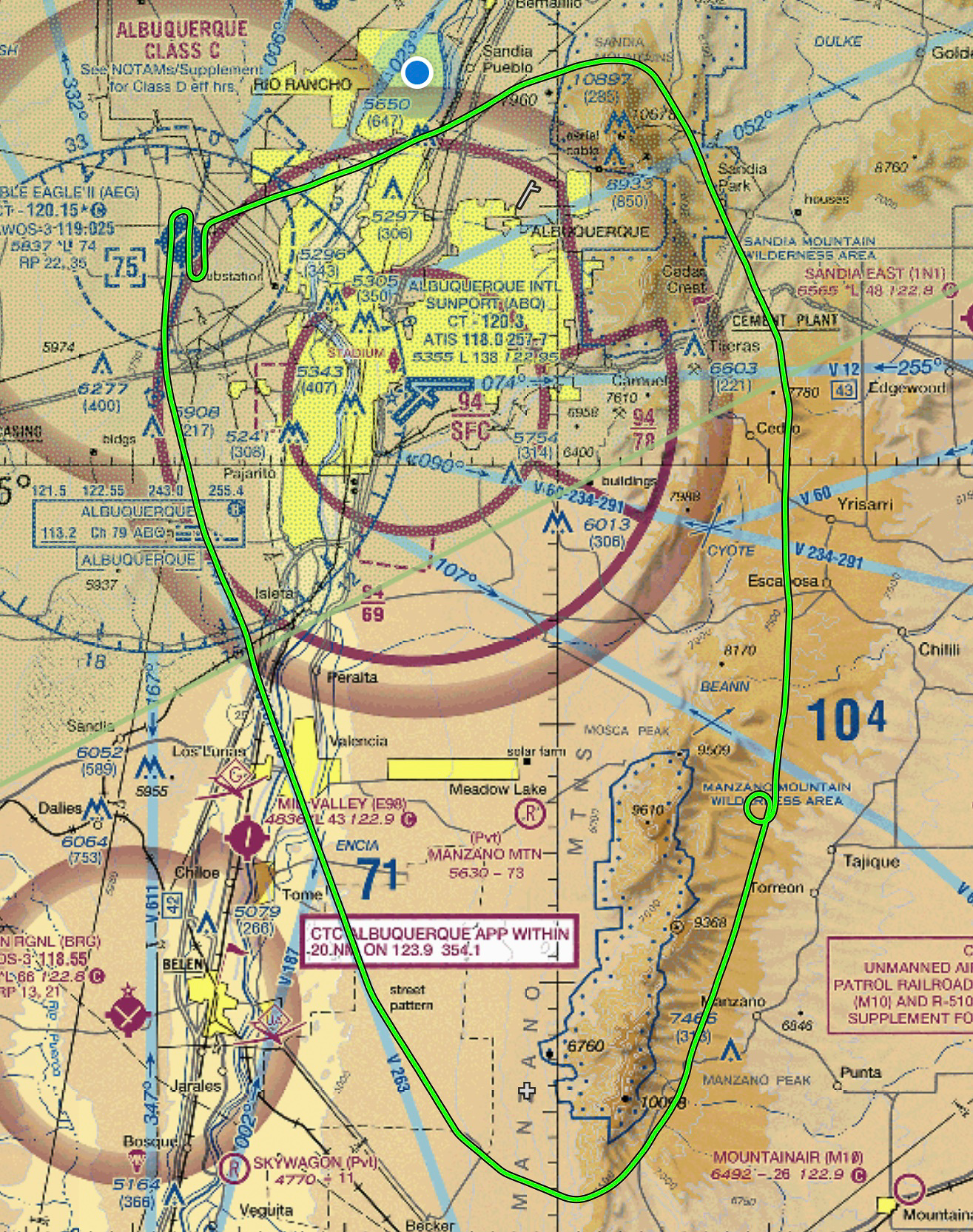
Route of Flight shown on VFR Flight Chart
This map, exported from our flight navigation system, shows the route of the 1.2 hour flight juxtaposed against the underlying geography and relevant air navigation information – basically a VFR flight chart. While I still insist on paper copies of this flight chart in the cockpit, we have become more and more comfortable relying on the electronic version and its incredible ability to quickly retrieve vast amounts of information on all aspects of the flight. Still there’s nothing like having the paper map.
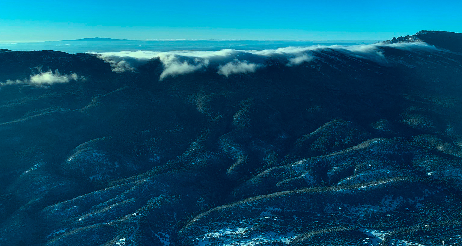
Orographic Clouds form over Sandia Range east of ABQ
One of the most interesting aspects of flying around mountains is the weather. Today, we had what I’d call a mini mountain wave or “lee wave” unfolding as the afternoon progressed. Increasing winds out of the west created an orographic lift along the west face of the Sandia & Manzano ranges. That would be the opposite side of the mountain as shown in the photo (left) and the same side as shown in the photo below. As we flew along the backside (east) of the ridge the clouds gave away clues of what was happening as the condensation formed and then flowed over and down the heavily forested east side. Then, several small, puffy, roll clouds formed just a bit further out from the mountain indicating a turbulent eddy of air that this process produces on the lee side. Winds were not strong enough or out of quite the right direction to form a real mountain wave but the setup was evident and very instructive of why flying the lee side of a wind blown mountain range must be done with due caution. There are many stories of pilots flying ignorantly into this type of situation and not living to tell the story.
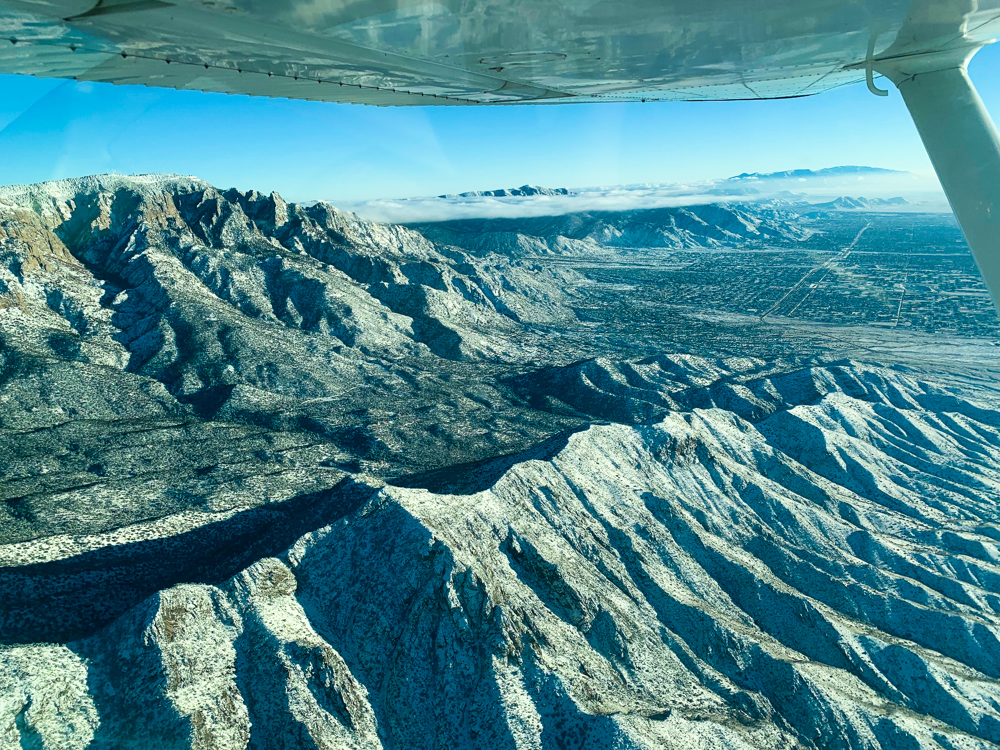
City from above Sandia Crest Wilderness
As we progressed further north we passed over the intersection of the Agua Sarsa & Crest trails where the frosted mountain fell away to the vast Rio Grande Valley to the west and the city to the south. It’s a spectacular view by any standard and best left to the viewer to describe for themselves. Suffice it to say, it was a beautiful day to be flying.