On my last trip to southern California, Claudia joined me at the end of the trip for a couple of weekend days of hiking. We looked at several places but decided to head east from the coast, up to the back edge of the “Inland Empire” to a idyllic (hence the name) little mountain village called Idyllwild, CA. This eastern edge of the Inland Empire is defined by two huge granite monoliths – to the north, Mt. Gorgonio (11,500′ & highest in SoCal) & to the south, San Jacinto Mtn. (10,600 ft) with I-10 running between the two from LA to Palm Springs. Eclectic Idyllwild is nestled in to an ancient, evergreen filled canyon on the western slope of San Jacinto about an hours drive south of I-10. It seemed as if at least one of every kind of people – and more of other kinds – live together in this sleepy town 2 hours from downtown LA. It has a long and rich history dating back to the early Americans, then to the Spanish conquest and on to the ranching and mining that dominated the last century. Now, tourism, the arts & crafts scene and the mountain climbing draw visitors from all over. The town also draws many SoCal area residents to their second homes located there.
We stayed at a local B&B as we always try to do. Hiking trails are accessible from town by foot or a short drive up the hill by car. The mountain looms over the tiny downtown and seems like only a stones throw away. Tahquitz peak (8,800 ft.) with its granite outcroppings (climbers covet them) has a very inviting fire tower at the top. Looks are very deceiving as we found out our first day – we climbed Tahquitz peak from the B&B and ended up climbing 3500 ft. up and logged about 12 miles in the bargain. We drug ourselves in too tired to talk just before dark. But, it looked so close!
-
- Looking west – Lily rock at left and Suicide rock at right frame the Devils Slide trail
-

- Lily rock – rock climbing area
-
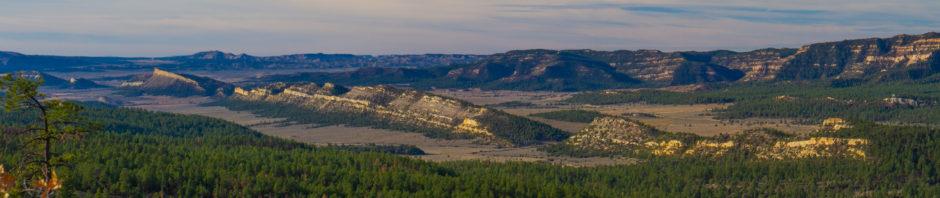
- Looking north towards San Jacinto from Tahquitz peak
-
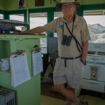
- Ranger Florian Boyd holds down the fort/fire tower
-

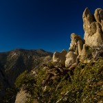
- Manzanillos cover parts of the slopes here
-
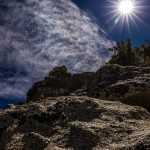
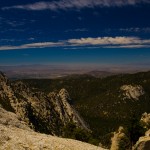
- Granite, Clouds & Sun
The next day we climbed Tahquitz again via the Devil’s slide trail. Giant granite formations on each side of the valley draw rock climbers from all over. Interestingly, there were hundreds of cars in the parking lot at the trail head but we didn’t see that many people on the trail. I guess they were on the granite climbing – or watching the climbers.
Reaching the fire lookout (still manned by volunteers) we met Ranger Boyd who educated us on the surrounding topography and showed us how they use the giant map compass in the center of the photo to locate and report fires. Quite interesting!
Enjoy the pics. And, put Idyllwild on your travel list.