A couple of months ago, we decided to install a new front fork and wheel and new, larger main tires on the Cessna 182 that would allow us to access New Mexico back country airstrips more safely and with a bit more sure-footedness. The plane was previously set up with “wheel pants” (aerodynamic covers) and smaller wheels and tires that are specifically designed for minimum drag on cross country flights and landing on paved airports. The new gear introduces more drag with the larger tires and elimination of the wheel pants but increases the strength of the system to handle the rigors of landing on unimproved strips typically found in the back country.
Last weekend, we finally got our first chance to test the gear on a patch of gravel about 1.5 hours south of Albuquerque in the Aldo Leopold Wilderness in SW New Mexico. This one is a USFS strip called “Me Own”. After a couple of fly-by’s and verifying that there weren’t any large pot holes or elk in the runway, we decided to attempt a landing. The new gear preformed as advertised and we spent the afternoon hiking around in some of the most remote and beautiful wilderness in the state.
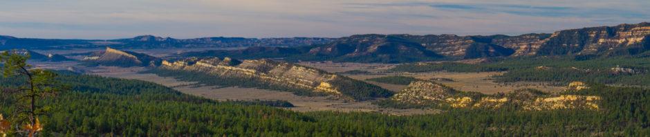
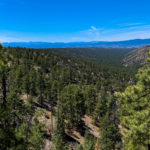
Ancient alligator junipers dotted the landscape along with pinyon pines and, where moisture allowed, ponderosa pines. The trees showed evidence of being tested by fire everywhere we walked and we could see vast slopes in the distance that had been completely cleared by fires of recent years. The only noises we heard were the occasional raven and jay announcing their displeasure at our invasion of their turf. And the wind. A sumptuously warm SW wind covered the area and continued to build during our short hike up the Grand Enchantment Trail. When we reached our first vantage point, the view into the vast expanse of wilderness to the west was as inspiring as it was humbling. Ancient volcanoes rise above the high desert and provide a dark backdrop to the green, pine clad valleys and ridges. This is a country built by volcanoes.
-
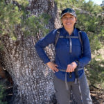
- A beautiful model poses in front of alligator juniper
-
- 50 miles of wilderness looking towards the AZ border
-
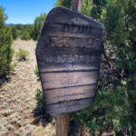
- A well worn badge of honor
-
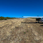
- 205JN positioned for takeoff
After a carefree couple of hours on the trail we returned to a dilemma back at the airstrip. Density altitude (relative air density) can be a real problem at high altitude airstrips as the already thin air becomes even less dense as temperatures rise. Pilots must carefully gather figures to calculate the airplane’s ability to lift off by factoring in altitude, temperature, aircraft weight, runway length, wind speed/direction and any obstacles that must be cleared at the end of the strip. Obviously, a calculator is required. Temperatures had risen to around 75 degrees on the 3000 foot strip and the we had a quartering tailwind that was gusting to over 12 mph. The calculator told us that the plane should start to fly in around 1000 feet even with the less than favorable wind at our tail. We sat on the runway watching the very active wind sock until we saw a pause in the action and decided to launch. I applied full throttle and watched the airspeed indicator as we gained ground speed. Unfortunately, it was only ground speed. The critical air speed indicator inside the airplane was indicating nothing as it bounced around on the peg at the bottom of the gauge. This was density altitude in action. If we pass the halfway mark on the airstrip and the proper airspeed is not indicated, that would be grounds for aborting the takeoff. We were getting close to that point, the indicator was still unresponsive and I was seriously considering an abortion (still legal in New Mexico). At the last possible moment, the needle began to come alive and soon indicated a sustained airspeed adequate to get the wheels to part with the gravel below. The plane performed as the book told us it would but nonetheless created some unwanted anxiety in this inexperienced backcountry pilot. Density altitude is interesting reading when studying for a written test but quite a bit more exhilarating when experiencing it while traveling at full speed and looking at the wrong end of the runway.
This was not the end of the story as we still had to get back home. Winds continued to build as predicted by the weather service. While somewhat turbulent, the trip back was quick as the now favorable tailwind pushed us northward towards Albuquerque. We forgot airplane calculations as we lumbered along looking down on ancient, twisted desert rocks. Winds had increased to 18 knots gusting to 26 knots out of 250 degrees at our home airport. Normally, this would not be a big deal as one of the runways (04/22) allows incoming aircraft to point their noses directly into the prevailing SW wind as they land. Unfortunately, this runway has been closed since a couple of months ago as contractors make needed repairs and upgrades. That leaves the other runway (17/35) and in this particular case meant a quite sporty, cross wind landing. On our first contact with the local air-traffic controller, he requested that I “state my intentions” after I had already verified our destination and that I had listened to the weather/wind forecast at the airport. That is coded speak which essentially means – hey pilot, are you sure you really want to do this? I stated that I’d like to extend my approach a bit to allow a bit more time to gauge the wind and if appropriate, I’d divert to an alternate airport with a more friendly runway alignment.
Crosswind landings are very stressful for some pilots and many would never attempt to tackle landings with winds that approach the maximum capabilities of the aircraft. I welcomed the practice but only after ensuring that I had an exit strategy if things didn’t go well. While 18 kts at an 80 degree angle (250 deg wind – 170 deg runway = 80 deg) is easily doable for the Cessna 182, a gust to 26 could just be enough to upset an otherwise enjoyable albeit exciting landing. The big issue for me this day were the unpredictable gusts. On the long approach the west winds will want to push the plane to the left. So, the wings are tilted to the right turning the nose into the wind to maintain a path directly along the runway alignment. Then, the the left rudder is applied to turn the nose back left so that the plane is tilted right wing down and the nose headed directly to the runway centerline. Here’s the tell. If you can’t maintain the runway alignment with the correct control inputs and the plane continues to move to the left, the wind is telling you it’s time to go elsewhere. Also, along the glide path down, any wind gusts that are strong enough to knock you out of alignment would be an indication that an alternate might just be called for. As we approached the runway, all indications were good so we made the decision to land and notified the controller. Flaps at 10 deg and a ready on the gas in case that gust arrived, we braced for touchdown. We flared to land and as the plane settled the right main wheel is first to touch down as the right wing is still dipped to the right. Then the front wheel touches as the plane, buffeted by the west wind wants to head left and off the runway. As the plane slows, the left tire eventually settles down on the runway as the control stick is still turned fully right into the wind. The controller gives us ground instructions and we exit and taxi to the ramp to park and reflect.
Beautiful NM spring weather, a flight over the always fascinating desert southwest, a pristine wilderness named after an iconic conservationist, and challenging flight conditions to get there and back all combined to make this a simply good day.